Monday 8 October 2012

Around the Edge of Wales (23)....Nefyn to Bangor


Around the edge of Wales (23)……Nefyn to Bangor

The last leg of the journey. So difficult to believe that it all ends today and to imagine myself back in the office tomorrow, sitting behind a desk and staring at a screen all day. 
But there’s plenty to look forward to today, on this final stretch. Although the forecast sounded promising it doesn’t look too bright in Nefyn. The path leads around the back of the village towards the quarries south of the B4417 – quite a distance from the coast.

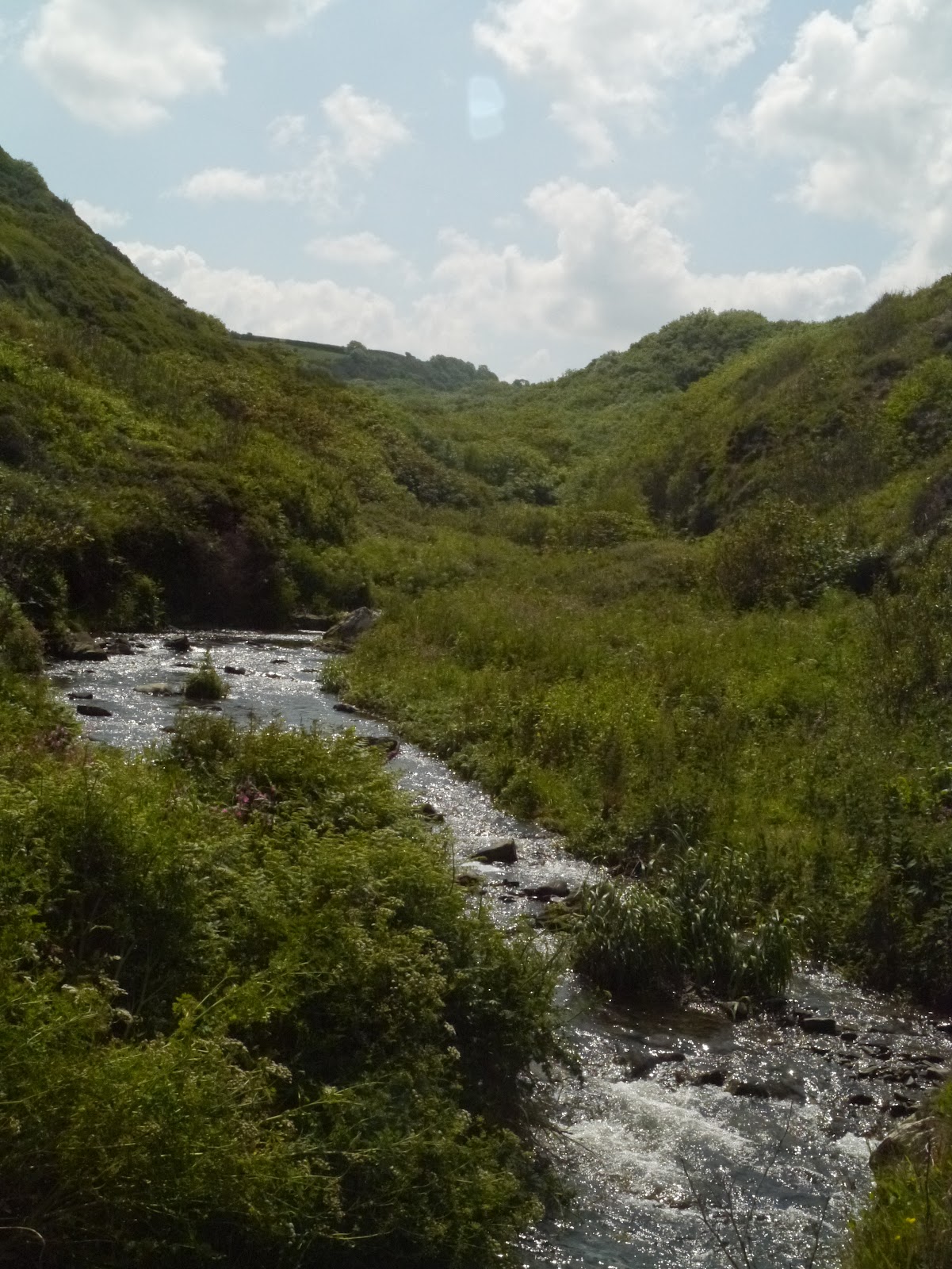
It wasn’t an enjoyable start to the day. Swathes of Himalayan balsam filled the stream alongside the path out of the village – it's been particularly noticeable this year. This invasive plant, introduced to Victorian gardens, is sprinting along banks of streams and rivers everywhere and is easy to identify in summer when the sickly scent of the pink and white slipper-like flowers fill the air. 


Further on along the path the summer growth was dense and wet – no scythe or strimmer had passed this way in months. There was no avoiding wet legs and soaking feet. Cursing the local authority I decided to come down from the mountainside and return to the road. It was a relief to walk on tarmac for half an hour, before reconnecting with the path at Pistyll and heading back down towards the cliffs.

But here again the silage fields were sheets of wet, flopped grass. I had no hope of keeping my feet  dry along this section either so I decided to paddle barefoot for a while through the mushy ryegrass. The puddled, silky soil squidged under my feet with every step, seeping between my toes. The ruined hotel on the clifftop at Pistyll was as grim as ever. A dark hulk of a skeleton – forbidding and very unloved. I wondered what its origins were and how its fortune, and then misfortune, had unfolded as I picked my way carefully through a herd of sullen cattle and cow pats, with one very nervous dog at my side.


Pistyll church is a lovely place to visit at any time, but especially in summer when parishioners spread grass and wildflowers on the floor. The smell of dry, mown hay seems to wrap itself around you as you enter. I spent some time in the church and graveyard looking for interesting carvings  on the headstones before heading off towards Craig y Nant headland. Plenty of walls and scree slopes along this section and it was no surprise to see so many wheatears. Another three choughs called above my head.


From Craig y Nant I decided to descend the steep slope to the long stony beach of Porth y Nant. My heart jumped when I spotted what  I thought was a line of dead moles strung above the beach – only to find as I got closer that they were a string of lone trainers, dangling sadly. Rescued but unclaimed spoils of the sea!


I wondered about climbing back up from the beach to walk through Gallt y Bwlch woodland, which I’ve never explored properly, but rummaging through the flotsam and jetsam was too enjoyable so decided to leave the woods for another day. I was glad that I’d stayed on the beach as I saw, for the first time on the this journey, a beautiful patch of horned poppy growing from the shingle close to Nant Gwrtheyrn. Glaucous leaves and papery yellow flowers against the greys and browns of the pebbles – just beautiful.


I stopped at Nant Gwrtheyrn for a sandwich at Caffi Meinir. Nant Gwrtheyrn is well worth visiting, between the houses that have been beautifully restored, the excellent café and the interesting interpretation that reveals so much about the history of the village and its community.

At last it was getting warmer, but escaping from the Nant meant a long, steep climb to the path that leads across the flanks of the Eifl. Through a small conifer plantation, to start, with goldcrests and long tailed tits chirping and flitting between branches. A sparrowhawk glided silently beneath the dark canopy, though the thin mist that rose from the steaming earth. In the distance a narrow skein of a waterfall  pounded over the edge of the cliff below the summit of Yr Eifl, slicing the air in a sheer vertical descent. I chatted for a while with a couple who had just started to walk down to the village but were just beginning to reassess their plans as the reality of the return journey dawned on them.


The path across the Eifl is an easy stone track through heather. In no time at all I’d reached the abandoned granite quarries of Trefor. There was no one else in this eerie, dramatic and boulder-ridden place where slopes and cliff faces have been hewn over centuries and where deserted buildings seem to cling to rock edges like left over parts of a film set. Everywhere was silent. Not a single bird had chosen to nest in the folorn man-made structures, but the views down towards Trefor, over to Gyrn Goch, Gyrn Ddu and Clynnog were amazing – as well as the view down to Moel y Gest near Porthmadog. I was glad though to come across the path that led me steeply down an incline to Trefor village, past meadows where a tiny tractor purred in the late sun, with a chorus of noisy gulls following in its wake.


Out again to the coast, through Moelfre farm which is now owned by the National Trust. A popular stretch of coast where a good numbermore people were walking and some even running across the soft grassy clifftop.  I quickly reached the attractive harbour at the edge of Trefor and sat down for five minutes to study the map again to see if I could follow the line of the coast to Pontllyfni and Dinas Dinlle.

No such luck. From here the coast path follows the cycle track along the new road that flies past Clynnog. I decided to phone home and ask if I could have the Airnimal bike back for this final leg – especially as it was now 5pm! I’d lost hours struggling through the wet early-morning vegetation, chatting at Pistyll church and taking photos around Nant Gwrtheyrn.

The bike ride was brilliant – a good track all the way to Glynllifon, along the old road through Clynnog village, then down to Llandwrog and Dinas Dinlle before turning back to join the beautiful road that skirts the edge of the Foryd estuary towards Caernarfon. The estuary was mesmerising in the evening sun and the Anglesey coast seemed to be within touching distance.


I rounded into Caernarfon from the edge of the Menai straits – my favourite view of the town, a mix of old elegant terraces, harbour and castle. Skimmed the pavements through town then out to Felinheli where the smell of food from the open windows of the Gardd Fôn, down on the front, was almost too tempting. I pressed on though, determined to finish the journey that evening, and quickly joined Lôn Adda, the new cycle route through Bangor. The sky was still a brilliant blue in Port Penrhyn. I found that the old Dickies boatyard had been erased  and the site scalped to soil – a massive board advertised the imminent arrival of new flats and I sensed that the place was about to be blotted by another monstrosity to rival the Victoria dock development in Caernarfon

A quick ride over to the gates of Penrhyn Castle, so that I could at least say that I’d ended the journey exactly where I’d started, then back to Bangor Pier for a final walk over the boards. At 9pm the sun was sweeping over the Carneddau mountains to the east, and gilding the Straits and its woodland edges towards the west. Stunning.


Back to the Tap and Spile for a pint  - and a welcome lift home.

But the following morning I would have started over again. One of the best, most memorable journeys ever.


Home - at the end of the journey


Monday 24 September 2012

Around the Edge of Wales (22).....Penrhyndeudraeth to Pistyll


Around the edge of Wales (22) ….Penrhyndeudraeth to Pistyll

The Llŷn Peninsula has a beautiful coastline but the current coast path route doesn’t allow you to get too close to it in many areas. Having studied the maps and seen how much of the path follows tracks and roads I decide to cycle the peninsula and switch to walking on the north coast.


Early morning near the toll bridge in Penrhyndeudraeth and the tide is out. Ynys Gifftan squats in bright sun, Portmeirion village is just about visible in the distance, and I begin to cycle westwards. Now that the Porthmadog bypass is open the old road into Porthmadog town is much quieter and a roadside pavement, combined with an excellent cycle track alongside the Cob provides a traffic free route all the way from Penrhyndeudraeth. The view from the Cob across the Glaslyn estuary towards Cnicht and Snowdon is one of the most stunning in Wales. Could anyone ever tire of it?  Fortunately, the careful design of the new bypass – which sits low in the landscape and is devoid of vertical structures such as lights -  hasn’t detracted from this picturesque and dramatic panorama.


The recent improvements to the road to Morfa Bychan also meant an easy freewheel down from the turn to Borth y Gest, along a smooth tarmac surface. The road through the village and out to the beach took me past a duneland Site of Special Scientific and I was reminded of the case at work, about 12 years ago, to save it from being covered in holiday chalets as a result of developers’ enthusiasm to implement a historic planning consent granted some decades previously. It had been a bête noir of a case back then and had sparked a massive protest by the Welsh language movement. It was still contentious 12 years ago but the effort to save the site from development had paid off – although I wasn’t sure if there had been some further encroachment of caravans since then.

Back towards the main Porthmadog-Cricieth road  the route took me over a hill from where, at one point, you can see both Cricieth and Harlech castles at the same time. A pavement runs alongside the main road all the way to Cricieth, which was a relief although the road was virtually empty at this early hour.  My only company on the seafront at Cricieth was a council worker emptying the bins. A beam of sun hung over the Dwyryd estuary but  the day hadn’t yet woken up properly. A westerly wind chilled the air and slowed my journey as I travelled towards Pwllheli along the pavement cycle route created as part of the recent road improvements. The coastal wetland at Abererch looked attractive – unfortunately not an easily accessible area.
 
 
I was glad to stop for a coffee and toast at Pwllheli and was surprised to find a new Costa coffee house in the town. Did the place really need one? I decided to  use one of the other small, local coffee shops instead.  A gentle ride along the sinuous promenade pavement took me out to the edge of town, heading towards Llanbedrog. Some new houses were being built on the dune edge – yet more steel and glass balconies! Having passed some depressingly bland new houses being built ‘for the future’ at Llanbedrog  I was glad to climb up to Mynydd Tir y Cwmwd. A stunning heather headland  with brilliant views in all directions.  Abersoch was busy – full of shorts and flip-flops, lots of white and turquoise and all-terrain prams. Not a place to stop for long and I rattled quickly over the rough track through the golf course  to escape from the place.  The climb up to Machros and Bwlchtocyn at the other end was steep. Plenty of time to remember the case of the landowner who tipped rubble over the edge of the cliff about 12 years go – another difficult and testing piece of work that I inherited when I moved to north Wales to work.  Bwlchtocyn was sunny and warm. A bright little place, brilliant white houses and fuschia bushes.  Onwards I went to Llanengan with its strangely designed village hall and its huge chimney stack that would have been associated with some local industry in the past – brick perhaps? Down then to Hell’s Mouth, the only place in Wales now where the rare Welsh bee can be found. I  spent a bit of time looking for the creature near the patches of trefoil behind the beach and found a couple busily flying in and out of their nest holes in the sand. Back inland the route across the vast area of low lying land behind Porth Neigwl is rather uninspiring. The fields are large and improved and the verges were solid masses of dropwort. Dark humming clouds of flies kept on rising from the flowers as I wheeled by, whizzing madly around my head and crashing into my face.  It was good to get to the main road and turn towards Rhiw.


The last time I’d visited this part of the peninsula was when I was dealing with a road improvement scheme on the far side of Hell’s Mouth, when the cliff edge road past Treheli was beginning to show signs of rapid erosion and collapse. People were agitated about the proposal to carve a new route across the hill – it would mean cutting a swathe through one of the few areas of woodland on this far western end of the peninsula, and through the National Trust ‘Plas yn Rhiw property. I remember the son of the poet R.S.Thomas writing in protest from Japan – the proposed route would also cut across the slope above his parents’ cottage which he still owned.  Local people were increasingly frustrated at the prospect of delay which could mean them having to undertake massive detours to carry on with their normal daily lives. It was a sensitive piece of work and emotions were running high. We spent a long time discussing options and the fine detail of the final design to try and ensure the  road would avoid damaging habitats, would blend with the landscape and retain the feel of a small country road –Gwynedd Council, the National Trust and myself for the Countryside Council. I was intrigued to see how the  scheme had worked out as I’d changed jobs just before work started on the scheme.  I was so impressed. The Local Authority should have won some kind of rural design award for this project. It wasn’t until I noticed the old road below that I realised I was on the new one.  The narrower than usual carriageway, the lack of markings and lights, the stone walls and roadside trees were all as we’d planned and it looked good. 


The climb up to Rhiw village from the National Trust entrance to Plas yn Rhiw is uncomfortably steep. Local farmers in their little Kubotas were whizzing up and down but no one else was cycling or walking this slope! The views from here are stupendous though – over the Llŷn peninsula and towards Snowdonia. It was worth the walk to have the time to take it in. tiny ‘Cragen-Llŷn’ banners had been stapled to telegraph poles, drawing attention to the local protest group that has just been set up to oppose the Welsh Government’s proposal to designate a Highly Protected Marine Zone around the western end of the Llŷn peninsula.


On the long, 3 mile descent from  Rhiw to Aberdaron I stopped at Blawdty farm, at the side of the road, to photograph one of the old outbuildings that has been partly constructed out of a mixture of clay, straw and other materials. it must be one of the few clay buildings left on Llŷn. I stopped at the Ship in Aberdaron and  chatted outside to holiday makers for a good hour or two.  Most of them had been coming here for years and knew the area very well. I learnt that Rolf Harris was in the area filming a programme, though nobody seemed  to know what it was about, and that the tiny HSBC building on the sea front was on sale for £half a million!


Over to Anelog and to Whistling Sands where I stopped to walk for a bit, then on to Tudweiliog, Edern and Nefyn, following every small lane detour that I could and walking down to visit bays that I’d never seen before, such as Porth Llechen. I met only two cars in 3 hours and these north-facing beaches were empty despite feeling warm in the setting sun. By the time I reached Pistyll I was tired and decided to call it a day.

Tuesday 21 August 2012

Around the Edge of Wales (21)...Aberystwyth to Penrhyndeudraeth


Around the edge of Wales (21) … Aberystwyth to  Penrhyndeudraeth

Another ‘mixed- mode’ section that combined good walking and superb cycling. The journey took in some amazing sights, and perhaps provided my overall favourite view of the whole holiday.

This leg started with an easy walk from Aberystwyth, over the cliffs to caravan city at Clarach and then on to Borth, where I swapped for a bike to round the estuary to Machynlleth and on through Meirionnydd.  I’d left my full size bike in Pembrokeshire so this was an ideal opportunity to test the folding Airnimal ‘Joey explore’ bike that I’d purchased some time ago but hadn’t had a chance to use. The weather was fine, but  there wasn’t a single walker to be seen until I got to the monument at Borth cliffs.


I hadn’t wandered the cliffs beyond Clarach before, despite living in Aberystwyth for three years. The cliffs are dark grey, shaly and very friable along this section. There was a scary moment or two when Macsen the dog hopped over the edge of the cliff to land on a slumped shelf of loose material below  - and then found the rocks too friable to clamber back up.  I had to coax her along the cliff face, just hoping she’d keep her footing on the narrow, semi-level sections, until I could reach over the edge and help haul her upwards by the scruff of her neck. We just about managed it, whilst clumps of trefoil topped shale fell  away  underneath my arm as I leant over and as the dog scrambled madly over cascading shale. She was back on the lead for a long time after this near-miss episode.

Yet another red kite, accompanied by another couple of chough were again seen on the first headland  out of Clarach as I headed north, past a lovely and quite stately looking house perched above a well preserved lime kiln. Was the location, close to an eroding coastline, the reason for its rather sad and abandoned feel?  The sea defence in front of it was rapidly decaying – its days clearly numbered

.

Not the most interesting section, in terms of wildlife, between Clarach and Borth. But the view of  Cors Fochno (Borth Bog), behind the vast beach, and with the view of the mountains behind, is staggeringly beautiful. At the edge of the bog a solitary church stood out on a small hummock of land between the village and the rusty expanse behind – as if to underline its importance in this coastal, way-below-sea-level settlement.  As I approached the village I fell alongside a quartet of local tourism provider who were bemoaning the fact that Borth was short of sand. Why couldn’t they import sand as they do in Tenerife? And what was to be done about the prehistoric forest that was exposed at low tide? The stumps were covered with slippery slime and there was going to be a string of accidents this summer – they really should be removed in order to avert a tragedy for the local tourist industry. 

I scanned the beach, seeing miles of golden brown sand stretching out towards the mouth of the Dyfi estuary, and was looking forward to catching a glimpse of the sunken forest at low tide. I moved quickly onwards and opted to walk through Borth village, which I found to be far more attractive than I ever thought or remembered. The northern part of Borth beach was largely empty and I spent ages taking photos of various features and fiddling with camera settings.  I turned inland at Ynyslas, following the coast path signs, though I would have stayed longer on the beach and turned east much further on had I known the path was only skirting the edge of the dune and the adjacent golf course. From here, the Borth boatyard looked bizzare, as if hulls and masts were rising out of the bog!


I had to get to the edge of the estuary to catch a glimpse of the whole length of the estuary at low tide. Aberdyfi looked beautiful across the sliver of water. Windscreens glinted along the edge of the dunes and the odd car arrived to perform a few wheelies on the compacted sand – cheap entertainment at the £1-a-go parking charge (surely far too low a fee for the ability to spend a whole day in an amazing landscape and a special National Nature Reserve?).

The ride to Machynlleth was quiet and relaxing, along flat terrain with virtually no traffic until I got to the main road, through Llancynfelyn. The traffic lights on the main Aberystwyth-Machynlleth road provided an opportunity to admire the walling work being undertaken as part of the road straightening and widening works on the Dyfi bends. The ride also took me past the Montgomeryshire Wildlife Trust reserve at Cors Dyfi – where removal of a conifer plantation some years ago has resulted in the restoration of estuarine marsh habitat and where the appearance of nesting osprey in recent years has created an interesting roadside visitor attraction and a focus for some great wildlife volunteering work.


I stopped for some refreshment as soon as I got into Aberdyfi and took a walk along the row of harbour terrace houses, each with its tiny but enviable sea-edge garden and explored the coast around the corner, where a stepped path has been hewn into the grey rock that is layered finely like filo pastry.


The main road along the Meirionnydd coast is probably the best route to follow if you want to keep close to the sea. The official coast path detoured madly all over the place but on a quiet Sunday afternoon the road felt like a cycle route and I decided to stick to it, for a while at least.  I rode through Tywyn, then on to Rhoslefain and Ardudwy.  I hadn’t been along this road for at least 10 years. The Halo honey ice cream factory was still to be seen, along the main road to Bryncrug, with plenty of people sitting outside sampling the stuff, and  Craig y Deryn from the Dysynni  Bridge looked captivating – but just a bit more hidden by trees than when I was last travelling along this road.  


Broadwater, from the Rhoslefain road, seemed to be a huge expanse of silver water, locked behind the  seafront. Tonfannau was quiet, and strangely enough someone appeared to be living in the old military camp, with sheets and pillowcases billowing n a line outside one of the brick cabins.
The view, when you travel northwards from Rhoslefain to meet the sea again is superb. It catches my breath every time, and especially in the afternoon light. It’s the combination of small fields and the snaking stone walls curving downwards from the mountains, and the  long curve of this north Cardigan bay sweeping round to the Llŷn peninsula. It’s usually over in a split second, if you’re driving, so it was a real treat to be able to enjoy it for longer on the bike.  A microlight pilot was taking in the sights at even a more leisurely pace. It whirred past slowly along the edge of the low cliffs, gently descending until it landed somewhere around Llanaber.


I stopped at Llwyngwril to search for the Quakers graveyard and eventually found it – a sweet place perched above the sea, with a tiny gated entrance. I was surprised how few graves  were visible in the western part of the graveyard that had been allocated for Quaker burials when the site was taken over by Wesleyan Methodists and wondered why this was the case. 


On to Fairbourne , over the lovely flatlands of Mawddach marsh,  to cross the estuary  to Barmouth . There were plenty of people walking over the old railway bridge at this end-of-afternoon hour, along with a few fishermen, but no other cyclists. Mawddach estuary, along with the Dyfi and the Dwyryd estuaries must be some of the lovelies coastal views in the world – and the train ride between Machynlleth and Pwllheli has to be one of the best ways to see them all in one lazy, fell swoop.

Barmouth  isn’t the loveliest of towns. Many of the local stone houses look dark, dour and rather forbidding. But I enjoyed the ride along the promenade and came across the local ‘rheinws’ or lock up  - divided to house both males and females  as the town had a reputation for rough women back in the 18th-19th centuries. The cycling was easy along this north Meirionnydd section with the road quiet and the pavement providing an alternative cycle track. I stopped in Dyffryn  Ardudwy to have a look at the amazing chambered tomb behind the primary school. The evening was warm and the sun was beginning to sink in a haze of orange and pink above the low coastal fields and old airforce site below the coast road. I stopped in the pub at Llanbedr for a swift half pint and chatted for a while to a lovely couple from Kent who were visiting the area for the first time. I was glad of the gift of an extra packet of crisps – I reckoned I’d need it before the evening was out. At Llanfair I decided to turn inland to follow the Ardudwy way to Llandecwyn  (Sustrans’ route 8). A decision I’ll never regret. I think this was the best cycle ride I’ve ever experienced in my life. The sun blazed ever more strongly as it sank behind the darkening Llŷn hills, but  to the south, the slopes of the Rhinog mountains were still warm and glowing in the dying rays . Such a  magical place. It was a temptation to stay but I needed to press on especially as I had no lights on this bike either.  I careered down the hills towards Bryn Bwbach, and out to the main road that leads to the toll bridge across the Dwyryd estuary. The end of a perfect  day.


Sunday 19 August 2012

Around the Edge of Wales (20)...Llanon to Aberystwyth


Around the edge of Wales (20)….Llanon to Aberystwyth

10am above Llanrhystud, under a blue sky, I find myself standing eye to eye with a hovering red kite. Three chough are wheeling above my head. There is no one else around – not now, not all day.


The path north of Llanrhystud opened up one of the loveliest views I’d seen throughout my journey. I’d never imagined that the coastline, west of the Blaenplwyf mast, fell away in such a beautiful sweep, reminiscent of the Rhosili coast. On these Penderi slopes black backed gulls were mobbing a buzzard whilst another kite circled lazily above the woodland that clung to the cliffs. A flock of six chough swooped, dived and pecked around a ruined farmhouse and its collapsed hedgebanks, whilst a team of two workmen strimmed the path nearby, creating a soft carpet of grass cuttings underfoot and a fresh smell of mown grass through tunnels of hawthorn trees.


The long detour around the Morfa Bychan caravan site was frustrating and the next part, along steep slopes, was hard on the ankles. High above Tanybwlch beach, where the steep black shaly cliffs are sparsely covered with strange yellowy-orange vegetation, the blustering easterly winds made it almost impossible to stand up. Below me, the low fields behind the shingle ridge still showed signs of last week’s rains and floods. I ended the clifftop walk just as I’d started it – face to face with another red kite, and in the company of a pair of chough busily feeding below.


 At the southern end of Tanybwlch beach the rock formations were incredible. I stopped there for a while to take photographs, and to get out of the wind. The dog fell asleep on the cobbles nearby but when we set off again she was limping slightly. It started to rain again as we reached Aberystwyth harbour and I decided it was time to swap dogs and give Caio a break.


Saturday 18 August 2012

Around the Edge of Wales (19).....Llangrannog to Llanon


Around the edge of Wales  (19)… Llangrannog to Llanon

A sweltering start to the day, and a steep climb out of Llangrannog, accompanied by  three chough. The scar-restoration project at Lochtyn, that I’d been keen to see again as it had been one of my first National Trust tasks, was looking pretty good – especially on the lower side of the track. The path north of Llangrannog was dead shrew territory – although I perhaps wouldn’t have noticed the creatures had I not had my head down continuously, coping steadily with the steep climbs. Cwm Tydu had smartened up since I was last there about 15 years ago and the Pen y graig/Cwm Soden section of the coast was just as lovely as I remembered it, with its fascinating rock formations, its promontory fort crumbling into the sea and its beautiful cove backed by a deep wooded valley.


Five glossy chough fed noisily on a bare earth cliff cut just above the stream at the back of the cove at Cwm Soden, seemingly oblivious to the people wandering within 3 metres of them. Coybal was another steep and strenuous climb, before New Quay head came into view, with its nesting seabirds and mussel processing plant churning brown gunk into a turquoise sea. The path here is so precipitous, so close to the edge that the local authority has offered an alternative! I decide to put the dog on a lead and brave the more dangerous path but have no appetite to hang around and peer over the edge to catch a glimpse of the auks. From far below , the commentary from one of the dolphin-spotting boats drifed upwards .

New Quay still retains quite a bit of its old harbour town character and I love the rows of beautiful Cardiganshire coast houses and terraces. I stopped to buy a sandwich for an extremely tired dog and catch up with phone calls. I learnt from an interpretation panel above the beach that New Quay had been the inspiration for Dylan Thomas’ ‘Under Milk Wood’ and that he’d started to write the play when he lived here for a year in 1944.


From New Quay the path led on through woods and along a beach where low cliffs were slumping  and slipping seawards and where beach boulders were solid puddings of clay and pebbles. Just before Gilfach yr Halen the dog suddenly started and jumped backwards – I edged closer and came across a fox cub, curled in the long grass alongside the path. It was alive, but lifeless. Its black eyes were dull and its ears barely moved as the dog craned towards it. A bluebottle landed on its head, bright turquoise against the pale rust fur, sensing imminent death. It looked like a case of poisoning. I searched around for a heavy stone or a piece of wood, but was relieved in a way that there was no suitable object around, fearing that I might only cause more suffering if I were to try to put the creature out of its misery.


Past the ticky-tacky holiday chalets in Gilfach yr Halen the path led easily on to Aberaeron. Clouds were gathering in black and pink masses across the southern part of Cardigan Bay as I stopped for a coffee and a chocolate croissant in the lovely ‘Naturally Scrumptious’ deli at Aberaeron. The dog was grateful for the gift of meat shavings cleaned off the slicing machine at the end of the day,  and we set off again along the low pebble shore in front of the vast fields north of the town, picking our way through teasels and trefoil before following grassy margins and lanes into the pretty village of Aberarth.


I’ve often wondered how it could be possible to create a path along the section of cliff that falls away so steeply, so frighteningly, along the side of the coastal road north of Aberarth. From the seaward side though the coast is broader than I’d imagined, and the path is beautiful, even and wide with amazing views down to the flat coastline at Llanon and the series of headlands beyond. The sea suddenly changed colour and became a slab of slate with silvery veins running through it. The skies opened in Llanon, heralding the end of the walk.